 Siddharth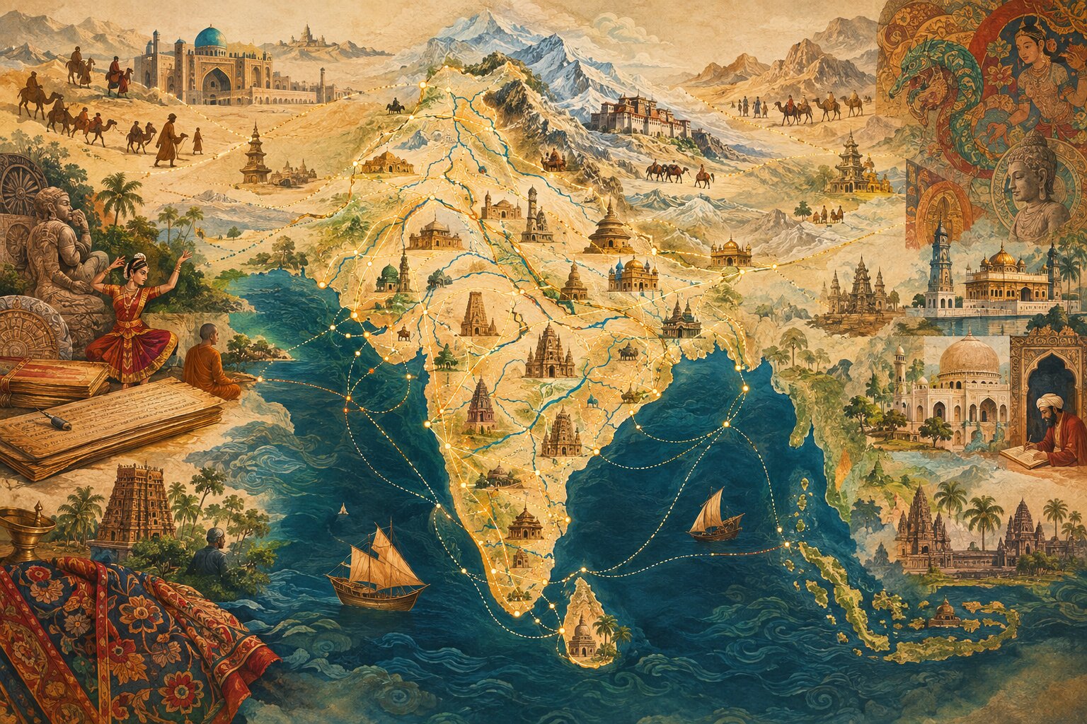
Every alternate semester at Plaksha University, I teach a course that touches upon many facets of Indian civilisation, such as philosophical schools (Vedanta, Yoga, Samkhya, Buddhism, among others), their foundational texts like the Upanishads, Bhagavad Gita, Ashtavakra Gita, Dhammapada, and Brahma Sutras, and how our philosophy and associated cultural practices are quite different from those of the Graeco-Roman civilisation of the West. Earlier this year, I much enjoyed teaching the course to only a handful of interested students since a smaller class meant that students were really motivated and engaged. Going beyond just the civilisational heritage, we also discussed how our civilisational institutions of the past worked by embedding within them the ideals of our civilisation, the disconnect between those ideals and our present institutions that have been inherited from the West, and building 21st-century relevant institutions our way rather than the Western way going ahead. I am still reflecting and writing on many of those subjects and will publish about them separately.
For now, let me talk about a mini-project that was inspired by the course but only received a tangible form in the past couple of months. It is quite evident that India’s geography is connected across space and time through many networks of tirthas, pilgrimage routes, Mathas (monasteries), and the flow of ideas, people, arts, music, and philosophical traditions for millennia. These have extended far beyond the modern political boundaries within the Indian subcontinent and beyond. My continuous travels to other parts of India since childhood have made me acutely aware of the many pilgrimage networks, philosophical lineages, and religious traditions that have shaped this sacred land.
For example, Hamsa (mythical swan) features in the emblem of both Sringeri Math and Belur Math, separated by more than 1000 years and many kilometers apart. This is because both of them are proponents of Advaita Vedanta, in which the Hamsa bird is a metaphor for being able to discriminate between Brahman (one all-pervading consciousness) and Atman (the Self) by the shattering of illusion (Maya). Similar connections across religious traditions are also evident in the practice of sending priests from one part of the Indian subcontinent to another, such as from coastal Karnataka to Pashupatinath Temple in Kathmandu, Nepal. Such civilisational connections across space and time truly make our land the most fascinating geography. Another example is the connection between places as distant from each other as Varanasi, Kanchipuram, Jagannath Puri, Mount Kailash, Sri Lanka, etc., through the travels of Guru Nanak, who painstakingly compiled the best of the Bhakti traditions’ verses from across India in the Adi Granth. When the course ended in May, my travels to Ladakh brought back many such connections to my mind through the beautiful landscape of Ladakh, across which the same Tibetan/Himalayan culture is spread over three nuclear-powered nation-states, though the freedom of expression of the same is limited outside India. As another example, take the beautiful Thanjavur mural paintings and the Mysore woodwork art forms. Both of these marvellous art forms are connected to Hampi of the Vijayanagara Empire, upon whose destruction artisans moved to these locations, taking their craft with them, leading to its survival and later flourishing. Exploring Project Bharatam, you will find many fascinating connections between places in India and as far away as Cambodia, Indonesia, and China.
I thought it would perhaps be an interesting idea to show many such civilisational connections across space and time on a single web resource. Around the same time, Swaroop, one of the students who had taken my course earlier this year and had done absolutely well in it, asked to undertake an independent study project with me this semester. It did not take much convincing to ensure that he would take up this idea and bring it to fruition. In fact, there would not have been a better candidate than him to undertake this because of his own enthusiasm and interest in this area.
As a result, we present Project Bharatam, an interactive visualisation that brings our civilisational connections together in one interactive visualisation. We hope to make it a growing resource for the preservation and dissemination of knowledge about our civilisation—connecting places with the people, traditions, events, and journeys that have shaped them, and in the process, creating a larger civilisational continuum. We also integrated an AI chatbot named Bhārati so that you can converse with the repository and be able to explore civilisational connections that may not easily be apparent.
Our aim has been to be as comprehensive as possible, while recognising that no such visualisation can ever be complete. There will always be a place we have missed, a local tradition we have not encountered, or a connection that deserves to be recorded. Thus, we encourage the wider community to contribute local connections around their vicinity. This could be a temple, mosque, church, monastery, fort, archaeological site, village, festival, craft tradition, musical tradition, historical event, or cultural landmark near where you live that we have missed, and how it is connected to the larger civilisational continuum.
We also gratefully acknowledge and have cited the many resources that have been used to build Project Bharatam. We look forward to continuing to build on Project Bharatam as a valuable resource for promoting our civilisational ideal of preservation and dissemination of knowledge.
 Is There a Free Lunch After All? What Accelerating India’s Development Gets Right